Office software in the geospatial industry is essential for data analysis, map creation, report generation, project management, and decision support. It enables professionals to process field data, produce accurate maps, communicate findings effectively, and make informed decisions, contributing to the industry’s efficiency and the quality of geospatial information. The success of any project depends on producing accurate and relevant deliverables. Trimble Office Software provides robust QA/QC tools to ensure that the field data is correct with smooth data management to create the desired reports and draw correct inferences.
Trimble Business Center
Field to Finish CAD software
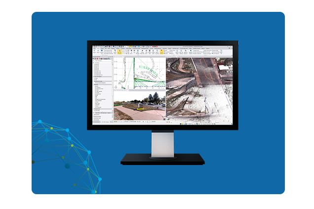
Trimble® Business Center (TBC) software empowers surveying professionals to convert field data collected from GNSS, total stations, laser scanning, mobile mapping, drones, and other sources into valuable, actionable information and high-quality deliverables for the clients. Trimble® Business Center (TBC) is one software environment which offers the flexibility and capabilities needed for multiple requirements of the project.
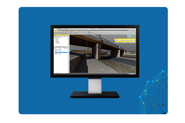
Effortlessly bring in point cloud data from a wide array of sources, and then expeditiously utilize Trimble® RealWorks™ software’s automated features and specialized workflows to swiftly process, analyze, and produce top-tier deliverables with exceptional precision. It registers, analyses, models and creates deliverables using data from virtually any source.
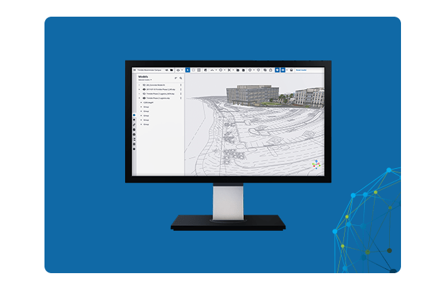
Establish seamless connections between individuals and data precisely when needed using Trimble Connect®, a cloud-based platform for collaboration and a common data environment (CDE). This cloud-based solution keeps every stakeholder informed about the latest project details as they’re updated. Maintains data security by following industry standards.