Mobile LiDAR (Light Detection and Ranging) in geospatial technology is a method for collecting precise 3D data of the Earth’s surface and surroundings using lasers mounted on a mobile platform, such as a vehicle or drone. It rapidly scans and measures distances to objects, creating detailed point clouds that capture terrain, buildings, vegetation, and infrastructure. Mobile LiDAR is valuable for applications like urban planning, transportation, and environmental monitoring, as it enables efficient and accurate data acquisition over large areas. This technology enhances mapping, modeling, and analysis for a wide range of industries, facilitating better-informed decision-making and improved infrastructure management.
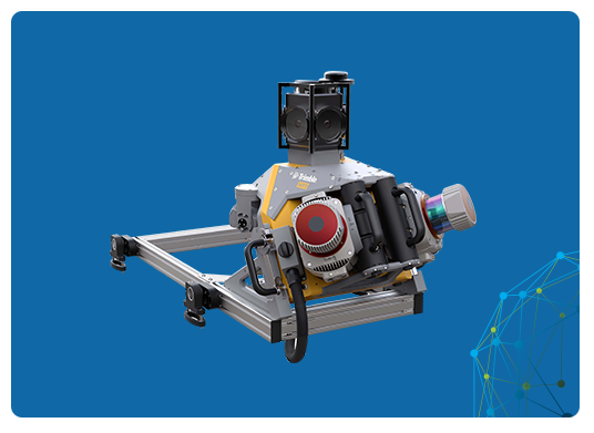
Trimble MX9
Productivity with Sophistication
The Trimble MX9 offers a comprehensive mobile mapping solution, seamlessly integrating cutting-edge hardware with user-friendly field and office software, streamlining the entire process from data collection in the field to its final processing. Advanced GNSS and inertial technology are fused with cutting-edge hardware, complemented by user-friendly field software that boasts effortless installation and operation.
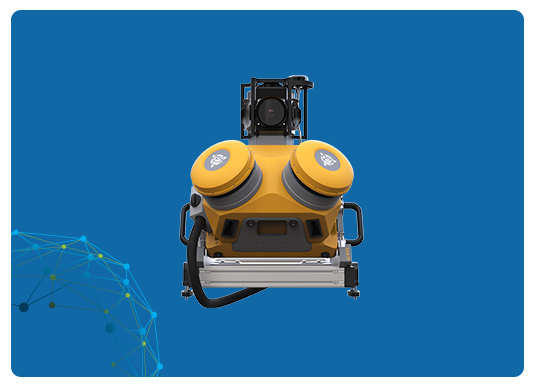
The Trimble MX50 mobile mapping system provides precise point clouds alongside immersive imagery, simplifying asset management, mapping, and maintenance tasks. Trimble MX50 will generate a step change in productivity, for both, novice as well as experienced users. It effortlessly captures, processes, extracts and shares data with proven field to finish workflows for asset mapping and asset data management.
The Trimble® MX7 is a vehicle-mounted imaging system enabling fast and productive capture of road, infrastructure and city environmental data. Capture 360-degree road data at highway speeds, saving costs and enhancing safety. Organize and share structured data through Trimble MX software for informed decision-making.